Lesson 2 - Mapping Canada
Activity 1 - Canada's Political Regions - The Provinces and Territories
1. Watch both videos on Canada and be ready to share 3 facts you learned.
2. When you are finished take the Canadian Provinces and Capitals pretest.
1. Watch both videos on Canada and be ready to share 3 facts you learned.
2. When you are finished take the Canadian Provinces and Capitals pretest.
|
|
|
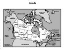
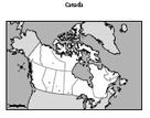
3. Practice naming and locating all 10 Canadian provinces and the three territories here.
4. Print out the blank map of Canada. Label and colour it with pencil crayons using the Map Colouring Rubric below.
 |
 |
Activity 2 - Canada's Physical Regions - From Sea to Sea to Sea!
Canada is a land of beautiful and diverse landscapes. Each physical region has specific characteristics.
1. We will look at these regions together through video and a website. The Physical Regions of Canada
1. We will look at these regions together through video and a website. The Physical Regions of Canada
|
2. Choose the region you find most interesting to research and present to the class in a powerpoint presention. You will choose 8 - 10 pictures which show the important features, tell the class why you chose each of the pictures and why this region was your favourite. You need to include the natural resources that are important to your region. Use websites below to find information and pictures to use in your powerpoint. Be sure to give credit to any website that you use to make your poweropint.
Canadian Landscape Photo Collection TrekEarth |
|
